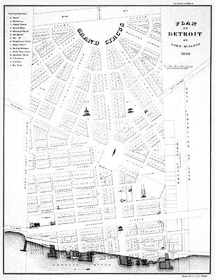
Detroit 1830 Historic Map Print - 17 1/2 x 14 inches
$45.00
Generated fro real data points and using architectural tools of the trade, this Detroit map features the most recognizable forms comprising of land, water and city streets.
This map was expertly designed with 100-percent vector-based data for the sharpest detail and the boldest colors. In other words, it's a high resolution print
Print is 12" x 18' and comes backed with cardboard stock
The Detroit Neighborhood Map is vetted by a team of locals and includes all neighborhoods within the city boundary in our signature minimalist style. Connect to the places and memories you...
12" x 18" Detroit MI Map Print Woodblock/ Green - Vertical
Sold Out$35.00
Custom map print of Detroit, Michigan featuring our woodblock style inspired by traditional Japanese woodblock art. Each print is expertly printed on museum quality matte paper in the US and...
12" x 18" Detroit MI Map Print Woodblock/ Green - Horizontal
$35.00
Custom map print of Detroit, Michigan featuring our woodblock style inspired by traditional Japanese woodblock art. Each print is expertly printed on museum quality matte paper in the US and...